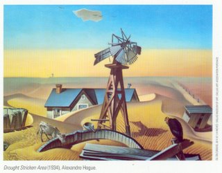
Wouldn't you know it--the deluge of 2005 is followed by the drought of 2006:
After Hurricanes Katrina and Rita blew through the New Orleans area, dumping nearly 1 1/2 feet of rainwater, many prayed for drier days to make work easier for rescuers and give their submerged city a chance to dry out.
"Be careful what you wish for," said state climatologist Barry Keim.
In a ironic twist after most of New Orleans sat submerged in water for weeks, the eight months since Oct. 1 have been the driest south Louisiana has seen in the 111 years that the state has kept rainfall records, he said.
Since October, most of the southern half of the state has averaged just 21 inches of rain, down from the usual 40-inch average, Keim said.
What's worse, other than a minor spike in rain chances beginning Friday and continuing into early next week, the rest of the month looks like more of the same, a National Weather Service forecaster said.
"We're in what's called extreme drought," Keim said of the state's record-breaking dry spell. "We've really been suffering here, especially since Katrina."
Then again, prior to the Katrina-Rita one-two punch, 2005 had been dry by Gret Stet standards. Shoot, I remember walking down by the river at some point last summer--probably right around the time I was reading Rising Tide--and thinking, nope, not this year...but there's more than one way to be inundated, I guess:
Southern Louisiana had been abnormally dry for about five months before the storm made landfall Aug. 29., Keim said.
"The drought was interrupted, if you will, by Katrina, and we went back into the drought pattern. Then we got that deluge from Rita. And as soon as that storm left, we went right back into the drought pattern," he said.
Normally, humidity rises into the sky, forming a cloud and then rain. But Keim said a stable structure of atmosphere is hanging over the region, preventing the moisture from rising, similar to the atmospheric conditions in normally arid states.
"For whatever reason, this dome of upper pressure in the atmosphere seems displaced east by a few hundred miles," Keim said.
The National Weather Service predicts that rain in the area will return to normal levels over the next three months. But Keim said such predictions typically can be way off.
"We're crossing our fingers," forecaster Tim Destri said. "We can't say for sure, but we see some hope of getting back to the typical summer pattern."
And let's hope 'typical' doesn't mean two monster hurricanes. I'd settle for a few middling afternoon showers, even if the subsequent heat DOES give everything kind of a parboiled feel. That's just a normal summer in the Gret Stet. I think my azaleas and tomatoes wouldn't mind it either...
No comments:
Post a Comment